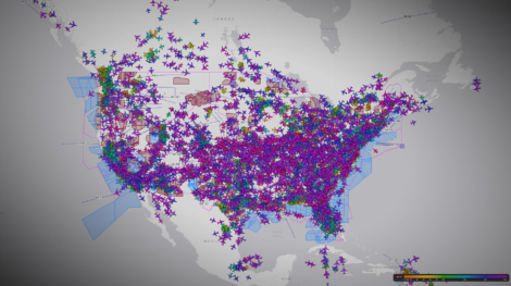
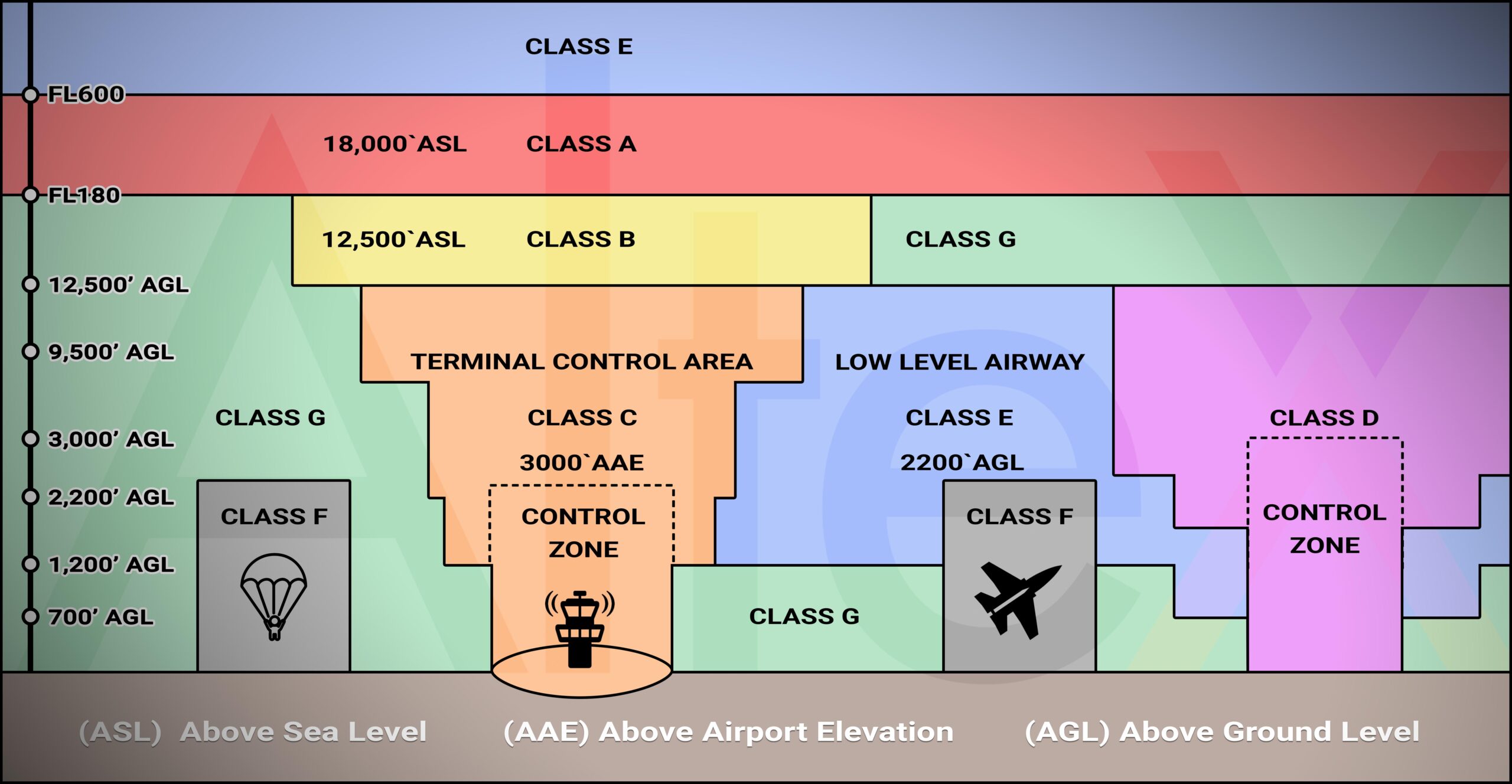
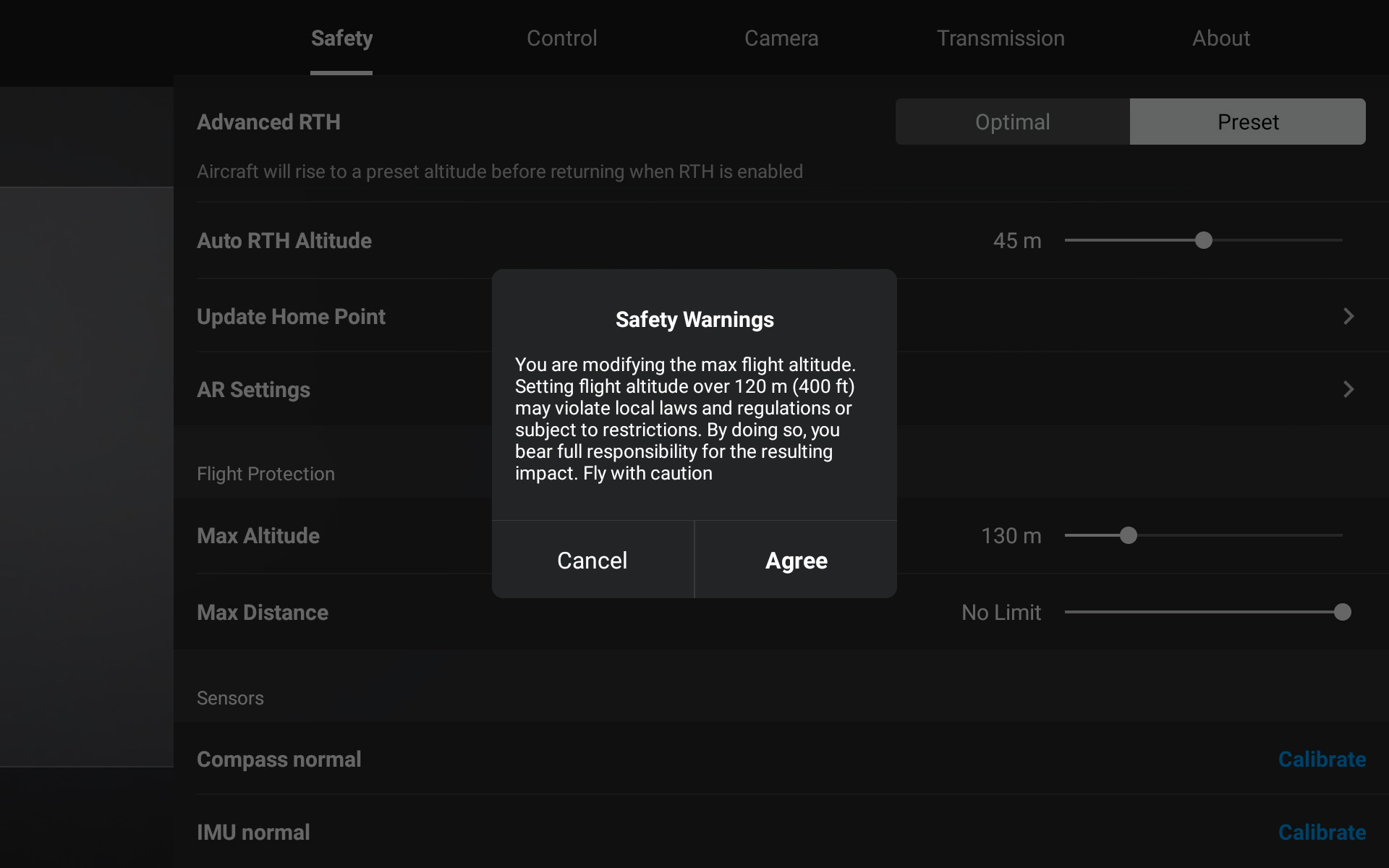
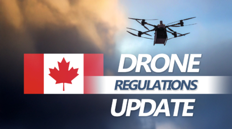
Picture of Yifei Zhao

Yifei Zhao

operations manager

Canadian Airspace Explained for Drone Pilots

CONTROLLED, RESTRICTED AND NO DRONE ZONES

Canadian Airspace Explained for Drone Pilots

CONTROLLED, RESTRICTED AND NO DRONE ZONES


Understanding Canadian Airspace

Understanding Canadian airspace is essential for drone pilots to fly safely and legally. Imagine driving a car without understanding road structures, highways, or school zones. The same principle applies to drone operations.

To understand Canadian Airspace, let’s first establish a few terms and players:

For drone pilots, airspace classification determines where you can flywhat other aircraft or activities may be operating nearbywhat approvals are required and how much planning is necessary before every flight.

In this article, we break down Canadian airspace into three practical categories relevant to drone pilots:

  • Controlled Airspace
  • Restricted Airspace
  • No Drone Zones

We also establish key concepts and tools that help you plan flights correctly and efficiently.

Airspace Foundations for Drone Pilots

CONTROLLED, RESTRICTED AND NO DRONE ZONES


Before diving into controlled airspace, restricted airspace, and no drone zones, let’s establish a few foundational concepts first.

The 400-Foot Maximum Altitude AGL (Above Ground Level)

Have you heard of the 400 Feet (120 Meters) Ceiling for Drone Flights?

It’s one of the most accepted rules for drone pilots.

Try setting the maximum altitude above 400 feet on your DJI controller and you will likely see a warning stating that this may violate air laws and regulations.

This warning exists for a reason! 

400 feet is the maximum altitude that Transport Canada and most national aviation authorities allow for small drones (250g – 25kg).

The reason behind this rule is Airspace Safety, specifically to separate drones from crewed aircraft.

In general:

  • Drones operate below 400 feet AGL
  • Crewed aircraft are expected to operate above 500 feet AGL, except during takeoff, landing or specialized operations

This creates a 100-foot Safety Buffer, which significantly reduces the risk of an in-air collision between a drone and a crewed aircraft.

Why Above Ground Level Matters

When reading an airspace map, AGL is a common abbreviation. It stands for Above Ground Level.

In contrast to ASL (Above Sea Level), AGL is mostly used for flights closer to the ground within a smaller geographical area, such as:

  • Drones
  • Helicopters
  • Agricultural Sprayers

AGL measures height relative to the Actual Terrain Below the Aircraft, while ASL is used for airplanes flying much higher in the sky and across longer distances.

Understanding AGL is essential for legal compliance and safe flight planning.

NAV Drone Viewer and NAV Drone Portal

CONTROLLED, RESTRICTED AND NO DRONE ZONES


NAV CANADA is the national corporation that manages Canada’s civil air traffic control. It provides official airspace information for all airspace users.

NAV CANADA offers two primary tools for drone pilots:

NAV Drone Viewer

The NAV Drone Viewer is the fastest way to check whether a drone flight is permitted at a location based on the operation type. Official Link: https://map.navdrone.ca/

Key characteristics:

    • No Account Required
    • Web and Mobile-Based
    • Clearly outlines where Drones Can or Cannot Fly based on Operation Type
    • Ideal for Quick Go/No-Go Decisions

To use the NAV Drone Viewer:

  • Select the correct operation type: Basic, Advanced, Micro drone or Level 1 Complex
  • Enter a location using an address, GPS coordinates, or by navigating the map
  • Confirm whether a drone can fly for your operation type

Flight Permitted at 3800 Lloydtown-Aurora Rd (AlteX droneHUB) for Basic Operations

Flight NOT Permitted at 3995 Cottrelle Blvd for Basic Operations

  • Click Help if you need more info on interpretation of the map

This tool is especially useful for recreational pilots and early-stage planning.

NAV Drone Portal

The NAV Drone Portal is a more advanced platform designed for detailed flight planning and airspace authorization.

Official Link: https://portal.navdrone.ca/

Key characteristics:

  • Free Account Registration Required
  • Allows Submission of Airspace Authorization Requests
  • Required for Controlled Airspace Access
  • Enables Advanced Pilots to Manage Operational Details such as Time Windows and Altitude Limits

For any operation in controlled airspace, the NAV Drone Portal is the official process to obtain authorization. Follow the official guides here to ensure your Nav Drone Portal account is setup correctly before using. You’ll need the correct pilot certificate and drone registration certificates uploaded.

Nav Drone Portal Support Page

Controlled Airspace

CONTROLLED, RESTRICTED AND NO DRONE ZONES


What Is Controlled Airspace?

Simply put, controlled airspace is airspace where Air Traffic Control (ATC) services are provided.

In Canada, ATC services are managed by NAV CANADA, which provides aircraft separation and traffic management within these areas. Any aircraft entering controlled airspace requires clearance or authorization. For drone pilots, after achieving the Adv. Drone Pilot License (Link to: AlteX Advanced Drone Pilot License Info: https://altexdronehub.com/shop/advanced-drone-pilot-license), flight planning and authorization can be processed on the NAV Drone Portal.

Controlled airspace allows drones to integrate safely into the national airspace, as long as the required approvals and operating conditions are followed.

Where Is Controlled Airspace?

Controlled airspace is most commonly found around large airports and naturally, around major cities.

It typically centers on an airport and expands outward in layers, often described as an upside-down wedding cake.

  • The innermost layer usually starts at ground level
  • It often extends up to about 2,500 feet vertically
  • The radius can be 5 nautical miles (NM) for a large international airport

Beyond this, each outer layer becomes higher and wider. For drone pilots, the lowest layer – from the ground up – is the most relevant, because it directly affects drone operations.

Controlled Airspace from Ground Up Around Toronto

Even though drones remain well below the upper limits of controlled airspace, authorization is still required whenever the airspace itself is controlled.

Common Misconceptions About Controlled Airspace

“I cannot fly a drone near airports, no matter the license.”
With the right license, drone and authorization, you can legally fly near airports.. (AlteX Advanced Drone Pilot License Info: https://altexdronehub.com/shop/advanced-drone-pilot-license) 

“It’s a long process to get approval for flights near airports.”
With recent updates from NAV CANADA, many authorization requests receive instant approval. Only higher-risk operations require manual review.

“I have NAV CANADA approval, so I can fly anytime at any height.”
Approvals are specific to date, time and altitude. Always follow the exact conditions listed in your authorization.

Key Takeaway

Controlled airspace is not about restriction. It is about coordination.

Restricted Airspace

CONTROLLED, RESTRICTED AND NO DRONE ZONES


What Is Restricted Airspace?

To better understand restricted airspace, we must first establish that airspace in Canada is managed federally (not including space under a roof). Even if a drone is flying an inch above the ground, it is still operating in federal airspace.

So what happens when special activities need dedicated airspace – such as military training, aircraft testing or parachuting?

That is where Restricted Airspace comes in.

Restricted airspace is created when an organization is granted exclusive use of a defined section of airspace by Transport Canada. During that time, all airspace activities inside that area is managed by the organization using it. It is like a private property. Anyone entering that airspace must obtain permission from the organization controlling it.

How Restricted Airspace Appears on Drone Maps

Restricted airspace is shown as Class F – Restricted Area on the NAV Drone Viewed and Nav Drone Portal.

Class F Airspace in Bordan

Controlled Airspace from Ground Up Around Toronto

Each restricted area listing includes:

  • The Airspace Designation
  • Lateral and Vertical Boundaries
  • Contact Information for the Controlling Organization

Any drone pilot wishing to operate in restricted airspace must obtain Direct Permission from the Listed Airspace Contact before flying.

Key Takeaway

Restricted Airspace exists to protect Specialized or High-Risk Aviation Activities.

Ask yourself:

  • Do you want to fly where Skydivers are coming down?
  • Or where Military Operations are happening?

If permission is not explicitly granted by the controlling organization, stay away from Restricted Airspace.

No Drone Zones

CONTROLLED, RESTRICTED AND NO DRONE ZONES


Why No Drone Zones Exist Outside Class F Airspace

Class F Restricted Airspace is formally published in the Canada Flight Supplement (CFS Link: https://products.navcanada.ca/shop-vfr/Canada-Flight-Supplement/), which is Canada’s official airport directory. However, not all drone restrictions appear as Class F airspace. There are many areas where drone flights are restricted or prohibited even though the airspace is not designated as Class F. These restrictions are still legally enforceable.

How No Drone Zones Appear on NAV Drone Map

On the NAV Drone Map, these areas appear through multiple layers, including:

No Drone Zones

These layers reflect restrictions driven by environmental protection, emergency response or temporary aviation activity, not just airspace classification.

Common Reasons for No Drone Zones

No drone zones are often established for:

  • Wildlife protection and sensitive habitats
  • National and provincial parks
  • Temporary flight restrictions for forest fires or emergencies
  • Special aviation activities such as summer airshows

Here’s an example of Drone Airshow Activity

Many of these restrictions are temporary and may change daily.

Key Takeaway

Not all drone restrictions come from Class F airspace.

If an area is marked as RPAS RestrictedParkNOTAM or No Drone Zone on the NAV Drone Map, drone flight is restricted or prohibited – even if the surrounding airspace appears otherwise open.

How to Efficiently Find the Appropriate Airspace for Your Drone Flights

I remember the early days of driving, when navigation meant interpreting printed maps. Today, my car displays Google Maps directly from my phone, providing clear directions, traffic updates and advanced safety features.

Drone navigation has followed a similar evolution.

In the past, drone pilots had to interpret the Canada Flight Supplement, work with aviation charts, reference NOTAMs and cross-check airspace activity across multiple systems.

Today, airspace planning is much simpler.

For Micro Drone Operations

  • Use the NAV Drone Viewer
  • Select the Micro Drone category
  • Confirm your flight area is not in a red zone
  • Check surrounding airspace for special activities and airports

For Basic Drone Operations

  • Use the NAV Drone Viewer
  • Select the Basic Drone category
  • Confirm your flight area is not in a red zone or National Parks airspace
  • Check nearby airports and airspace activities

For Advanced Drone Operations

  • Set up a NAV Drone Portal account
  • Upload pilot and drone registration certificates
  • Create an operation before each flight
  • Obtain authorization if flying in controlled airspace
  • Save flights for record keeping when applicable

Putting It All Together

CONTROLLED, RESTRICTED AND NO DRONE ZONES


Canadian airspace follows a clear and logical structure once you understand how the pieces fit together.

  • Controlled airspace is accessible for drones with authorization
  • Restricted airspace requires explicit permission from the controlling agency
  • No drone zones may exist outside airspace classifications

These airspace classifications are specific to Canada, but the fundamentals are the same internationally. Safe separation, protection of sensitive activities and shared airspace management are global aviation principles.

Once you understand the structure, airspace planning becomes repeatable, manageable and confident – no matter where you fly!

new
POSTs

AlteX_Canadian-Airspace4Drone-Pilots_000

Canadian Airspace Explained for Drone Pilots

Understanding Canadian airspace is essential for drone pilots to fly safely and legally. Imagine driving a car without understanding road structures, highways, or school zones. The same principle applies to drone operations.

AlteXdroneHUB_About_01-History_001

Introducing AlteX droneHUB

What began as one of Canada’s earliest drone schools has evolved into a connected ecosystem for drone training, R&D, and industry collaboration. As AlteX marks its 10-year milestone, we are proud to introduce the next chapter: AlteX droneHUB.

AlteX_ExpertGeophysics_RevolutionizingMineralExploration_FEATURED_001

Expert Geophysics Implementing Drones for Mineral Exploration

Expert Geophysics partnered with AlteX DroneHUB to train their pilots on the DJI Flycart 30, a heavy-lift drone built for demanding industrial applications. Their team completed both Advanced Drone Pilot certification and DJI Enterprise Training, gaining the tools and confidence to expand their drone operations.

Shopping Basket